Sarchu’s importance stems from its strategic location on the spectacular Manali-Leh highway. An important pit stop on the 475 kilometer stretch between Manali and Leh, Sarchu comes into focus between May to September every year when the snow thaws on this route. It becomes a transit campsite on one of the highest highways in the world that traverses five very high mountain passes. Travelers are advised to go slow and acclimatize at important points en route.
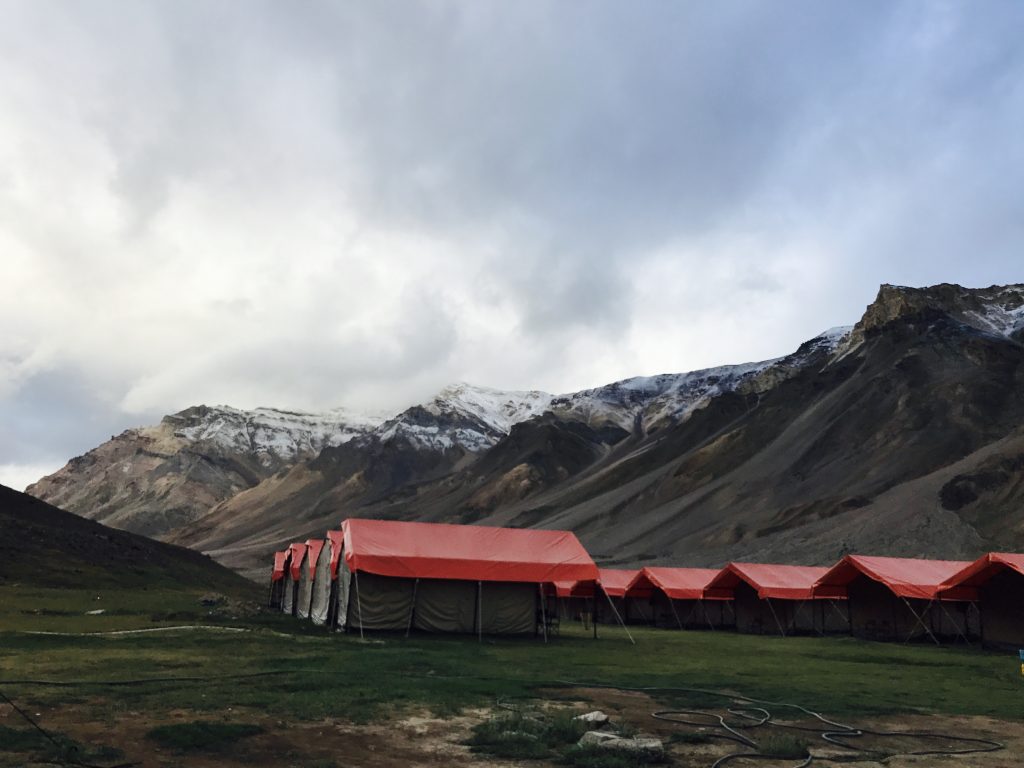
The Manali-Leh route is generally done with two overnight halts at Keylong and Sarchu. Although the distance between the two-night halts is barely over 100 kilometers, given the extremely high altitude terrain in between, the going is understandably very slow. This coupled with the fact that there’s very little accommodation available post-Sarchu right till Leh, makes it a popular stopover. Most travelers start experiencing the first symptoms of Acute Mountain Sickness (AMS) while approaching Baralacha La (Pass) at 16,500 feet. It comes as a relief soon after with warm beds, compact canvas tents, hygienic food, and eco-friendly waste and garbage disposal methods.
Sarchu
An otherwise high altitude, barren patch of land on the Manali-Leh highway, Sarchu comes into sharp focus from June to September every year when heavy snow on the highway begins to thaw. Adventure buffs (mostly on motorbikes) from the world over make a beeline to traverse this spectacular route. Sandwiched between two high mountain passes – Baralacha La and Nakee La – This is one of the two important night halts on the Manali-Leh highway along with Keylong. It becomes a transit campsite on one of the highest highways in the world that traverses five very high mountain passes.
Travelers are advised to go slow and acclimatize at important points en route. The terrain both before and after Sarchu rises to dizzying heights and it becomes imperative for travelers to break the journey here! This place is generally the second night halt while driving from Manali, and the first while coming in from Leh.
Baralacha La
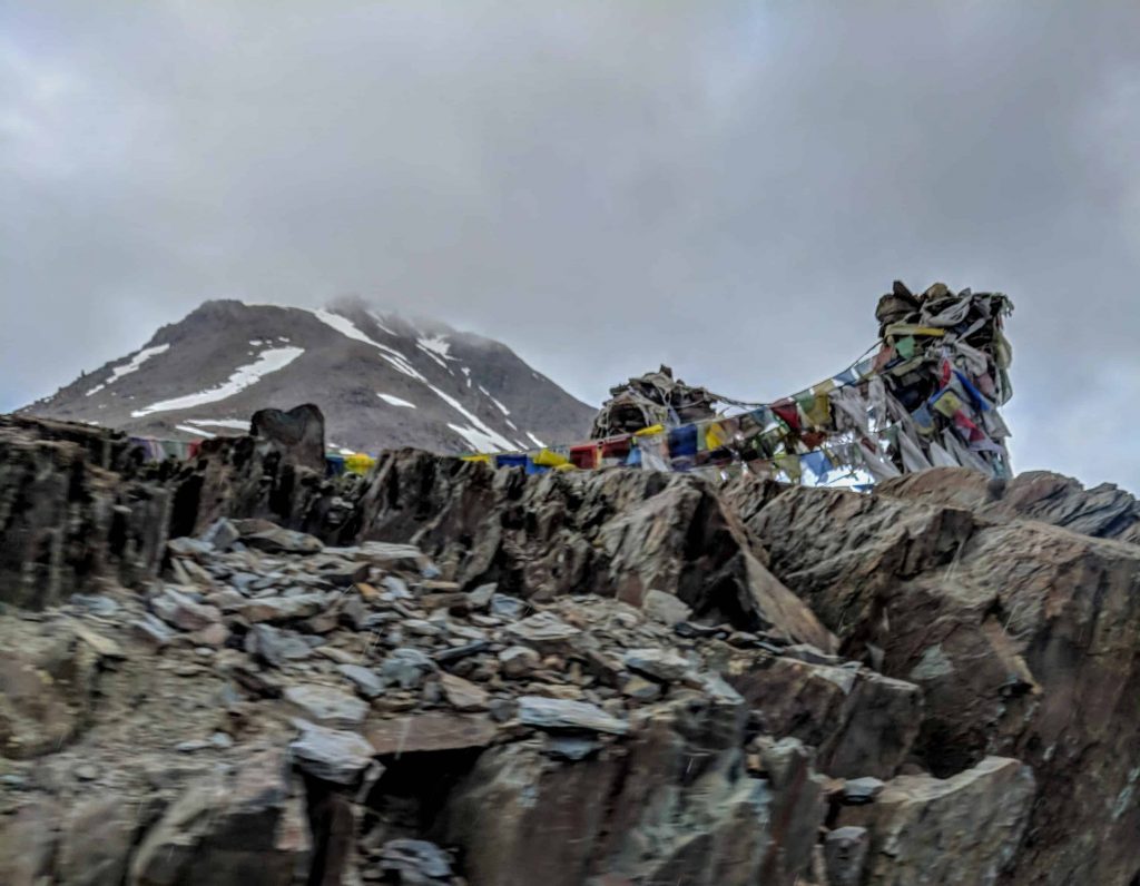
Post-Rohtang Pass is the first of the high passes that travelers encounter while driving in from the Manali side. Road condition starts to deteriorate after Darcha and the drive up to the 4,890 meters (16,040 feet) Baralacha La becomes a huge challenge. As the altitude rises sharply, many start noticing the first sign of Acute Mountain Sickness (AMS) in the form of nausea, loss of appetite, breathlessness, etc. In addition, one can also get cold-stroke. While the thrill of reaching the summit is heady, it is advisable to take it easy and not overstretch oneself. Spend as much time here as possible to acclimatize. Do not overeat, the golden rule here is ‘eat less, drink more.’
More Plains
The More (also pronounced as ‘Moray’ and ‘Moreh’) Plains are one of the highlights of the Manali-Leh highway. Soon after this place leaves the Himachal Pradesh border and enters Jammu and Kashmir. 70 odd kilometers from Sarchu is Pang, the next settlement in the region. Soon after Pang, the narrow road rises to open up to a high altitude plateau. The 45 kilometers long stretch of seemingly endless landscape is referred to as More Plains. At an average altitude of 15000 feet, the panoramic vistas that travelers encounter are exhilarating. It very often sweeps most travelers off their feet. Encountering the More Plains forces travelers to redefine their idea of the plains! Flanked by distant mountains on either side, the enormity of these Plains in front comes as a pleasant surprise.
Tanglang La
Tanglang La is one of the highest motorable passes in the world. While the veracity of the highest pass is in a constant state of flux with newer passes opening up without the world at large getting to know of them, what remains untenable is that it is the highest pass on the Manali-Leh highway. At about 17,582 feet (5,359 meters), Tanglang La is beautiful in its serenity. Travelers enthusiastically take pictures with the happy thought that post-Tanglang La Acute Mountain Sickness (AMS) will begin to peter out. The thought of reaching the relative comfort of Leh adds to the heady feeling of scaling such a high pass.
Walking and moving around in your own vehicle are the best ways of exploring the area around. Motorcycles can be hired from Manali. For the very adventurous, be the starting point for a trek to Zanskar.
Related Article – BREATHTAKING ALCHI – LEH
Frequently Asked Questions
Q. What is the average sarchu temperature?
The average temperature is -9.9 °C | 14.2 °F.
Q. How is sarchu weather?
Weather is cold across the year
Q. What is sarchu to leh distance?
The distance between Sarchu and Leh by road is 259 Kms. It will take around 8 hours on bike and 7 Hours by car, if you keep small pit stops.
Q. Sarchu altitude?
Sarchu (also known as Sir Bhum Chun) is a major halt point with tented accommodation in the Himalayas on the Leh-Manali Highway, on the boundary between Himachal Pradesh and Ladakh in India. It is situated between Baralacha La to the south and Lachulung La to the north, at an altitude of 4,290 m
Q. What is sarchu height?
It is situated at 14070ft above sea level.
Q. What are the best sarchu hotels?
- Dorje Camps
- Camp Himalayan Saga
- Himalayan Routes Camp
- Goldrop Camps
Q. What are options for sarchu accommodation?
Below are the best options available to stay –
- Dorje Camps
- Camp Himalayan Saga
- Himalayan Routes Camp
- Goldrop Camps
Q. Distance between sarchu and kibber wildlife sanctuary?
Distance Between Sarchu to Kibber Is 295 Kms. Kibber also Kyibar is a village high in the Spiti Valley in the Himalayas at 4270 metres or 14,200 ft in Himachal Pradesh in northern India. It contains a monastery and the Kibber Wildlife Sanctuary. It is located 20 kilometres from Kaza and a bus service connects them in the milder summer months.
Q. Does sarchu altitude sickness happens?
Yes, this happens with first time travelers at that altitude (14070ft).
Q. How is sarchu adventure camp?
Adventure is a good accommodation option present there.
Q. What activities can be done in sarchu?
Riders on their way to Ladakh pass through Sarchu which also serves as the base for trekking to Zanskar. Apart from trekking, you can also attend the various festivals held in Sarchu. Basant Panchami is the main festival and Diwali too is celebrated with great enthusiasm.
Q. What are the major sarchu attraction?
Below are the attractions which can be visited from Sarchu.
- Suraj Tal. Bodies of Water. 24.4 km from Sarchu.
- Baralacha Pass. Other Outdoor Activities. 44.3 km from Sarchu.
- Chandra Taal. Bodies of Water. 48.2 km from Sarchu.
- Chandertal Lake. Bodies of Water. 48.3 km from Sarchu.
Q. What is the distance between manali to sarchu by road?
Distance between Manali to Sarchu is 210 kms.
Q. Do we have manali to sarchu bus?
It is an ordinary bus that locals use to commute. Contrary to common belief, this is not actually a direct bus all the way to Leh. From Manali, you will first have to board a bus for Keylong and from there, catch a connecting bus to Leh.
Q. Distance from delhi to sarchu by road?
Distance from Delhi is 763 kms.

